A powerful storm, classified as a “bomb cyclone,” is forming off the Pacific Northwest coast, threatening more than seven million residents with a mix of high winds, heavy rainfall, and snow. This rapidly intensifying system is expected to worsen as the week progresses, bringing a range of hazardous conditions to states along the Pacific Ocean.
The National Oceanic and Atmospheric Administration (NOAA) has warned that the storm will bring not only extreme weather but also risks of flash flooding, landslides, and debris flows. Mountain regions are bracing for significant snow accumulation and blizzard-like conditions.
What Is a Bomb Cyclone?
A bomb cyclone is a meteorological term describing a storm system that rapidly strengthens as its central air pressure drops by at least 24 millibars within 24 hours. This rapid drop in pressure causes the system to intensify explosively, resulting in severe weather such as high winds, torrential rain, and heavy snowfall.
While these storms are not uncommon during this time of year, the combination of a bomb cyclone with an atmospheric river—a stream of concentrated moisture—heightens the potential for widespread impacts. This interaction can lead to prolonged periods of heavy precipitation and significant weather challenges for affected areas.
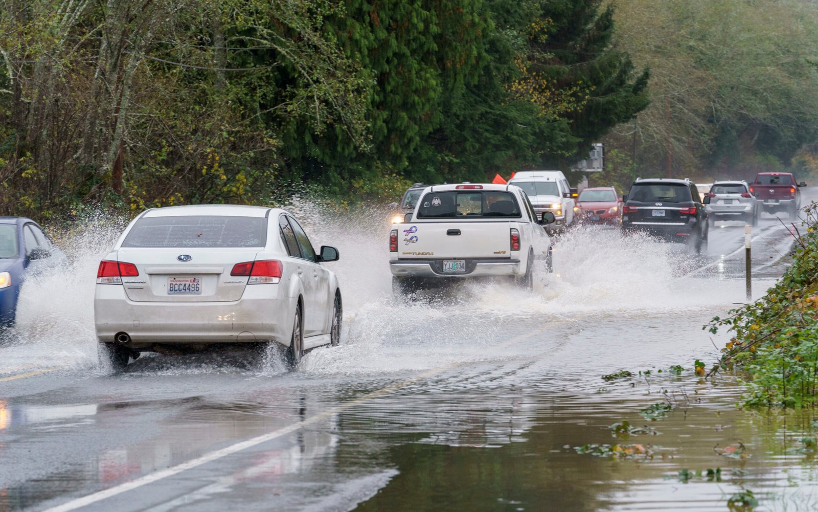
Storm Impacts on the Pacific Northwest
The storm has already begun impacting parts of the Northwest, with strong wind gusts reported in areas like Seattle. NOAA forecasts indicate that the storm will bring heavy, wet snow to mountain ranges, with accumulation rates reaching 2-3 inches per hour. In higher elevations, snowfall totals could range from 10 to 20 inches (25-50 cm), creating whiteout conditions that make travel dangerous.
Winds reaching up to 65 mph (104 km/h) are expected, posing risks of power outages and tree damage. Coastal areas are bracing for high surf and potential flooding, while inland regions could experience significant debris flows and landslides due to excessive rainfall. Northern California and southwestern Oregon are likely to see the heaviest rainfall, with localized flash floods and mudslides a major concern.
Weather Alerts and Preparedness
The National Weather Service has issued winter weather alerts and storm warnings for many areas along the Pacific Coast. Residents in northern California, southwestern Oregon, and parts of Washington are urged to remain vigilant and prepare for hazardous conditions. Travelers are advised to avoid mountain routes where whiteout conditions and blizzard-like weather are likely.
Flash floods and heavy snowfall are not the only threats. Coastal communities could face rising waters and damage from large waves driven by the intense winds. In some locations, rainfall may reach levels sufficient to trigger mudslides, particularly in areas already saturated from previous storms.
Timing and Forecast Details
The storm began making its presence felt on Tuesday and is expected to intensify through the end of the week. Mountain ranges in the Pacific Northwest will experience the brunt of the snowfall, while urban areas along the coastline can expect heavy rain and wind. NOAA has also issued a “high risk excessive rainfall outlook” for parts of northwest California.
The storm’s peak intensity is likely to occur mid-week, with a mix of rain, snow, and wind continuing to affect the region into the weekend. Power outages are expected as strong winds topple trees and down power lines. Officials are urging residents to secure loose items around their properties and prepare for extended periods without electricity.
Long-Term Weather Trends
This storm is part of a broader pattern of seasonal weather systems that typically impact the Pacific Northwest. Atmospheric rivers, which transport moisture from tropical regions, often collide with colder air masses in the area, leading to heavy rain and snowfall. The addition of a bomb cyclone to this pattern creates a more potent weather event with the potential for significant damage.
Communities in the storm’s path are encouraged to monitor updates from local authorities and NOAA to stay informed about changing conditions. Emergency supplies, including food, water, and backup power sources, are recommended for those in areas most likely to be affected.
Looking Ahead
As the storm progresses, its impacts will vary across the region. Coastal areas will see the highest winds and waves, while mountainous regions will endure the heaviest snowfall. Low-lying areas could face flooding from torrential rains, while rockslides and debris flows remain a risk for communities near steep terrain.
While the bomb cyclone is not unprecedented, its combination with an atmospheric river underscores the importance of preparedness. Residents should heed warnings and take precautions to ensure safety as the storm continues to develop and intensify.